How SSG Is Providing Better Data for Community Climate Adaptation

What does it take to adapt to climate change?


6 June 2024
The Town of Whitby, ON prevented over $17 billion of potential flood damage without spending a dime on flood protection barriers, storm surge gates, or other protective measures
The Town of Whitby, ON prevented over $17 billion of potential flood damage without spending a dime on flood protection barriers, storm surge gates, or other protective measures. Instead, they incorporated climate hazard modelling into their development considerations. When the modelling showed planned development areas would be right in a flood’s path, the Town shifted its plans.
Floods, wildfires, heat waves, cold snaps, and severe storms are increasing and the associated toll—in terms of deaths, damage to property, and the destruction of ecosystems—is increasing in frequency, magnitude, and cost.
As cities grapple with population growth and expand their built area, they must consider climate hazards in their urban plans and policies. Otherwise, they risk exposing their citizens to serious infrastructure damage and, in the worst cases, disability and death.
At SSG, we found that the communities we worked with needed more nuanced information about climate hazards to plan proactive responses. While they had plenty of data to analyze specific hazards, like heat waves, floods, and storms, they lacked a framework to objectively assess hazards, compare the cost of inaction to the cost of action, and identify priorities.
We’ve developed a planning approach centered around our ScenaAdaptation model to respond to this challenge. Drawing on data related to climate hazards, demographics, buildings, roads, existing hazards responses, and more, the model assesses the potential spatial impact of extreme weather events down to individual buildings. This helps pinpoint and prepare for varied risks. For example, areas where many homes are old and drafty may be more vulnerable to heat waves and cold snaps than those with newer buildings with better insulation. The model also quantifies the dollar value of potential damages to buildings and infrastructure. This information helps communities create plans and policies to minimize risks and prioritize how to allocate their resources to respond to hazards.
As cities grapple with population growth and expand their built area, they must consider climate hazards in their urban plans and policies.
SSG applied our ScenaAdaptation model to evaluate the cost of extreme weather events in the three scenarios.
Avoiding flood damage in Whitby
Located on the banks of Lake Ontario, Whitby faces a growing flood risk as more frequent and severe storms are expected to cause the lake and local creeks to overflow. SSG worked with the Town to assess the potential impact of severe storms based on three scenarios: one in which Whitby maintains the same population size and infrastructure, one in which Whitby’s population grows and infrastructure develops as currently planned, and one in which Whitby takes deliberate adaptive actions while growing.
Drawing on local data related to demographics, climate, and other trends, SSG applied our ScenaAdaptation model to evaluate the cost of extreme weather events in the three scenarios. The differences were visualized through maps showing how flooding would affect each area of Whitby in each scenario. ScenaAdaptation’s analysis showed that restricting the location of new development can prevent $17 billion in future damage to homes, buildings, and infrastructure that would affect over 9,000 people. The findings informed the Whitby Climate Emergency Response Plan.
Reducing the impact of heat waves in Kelowna
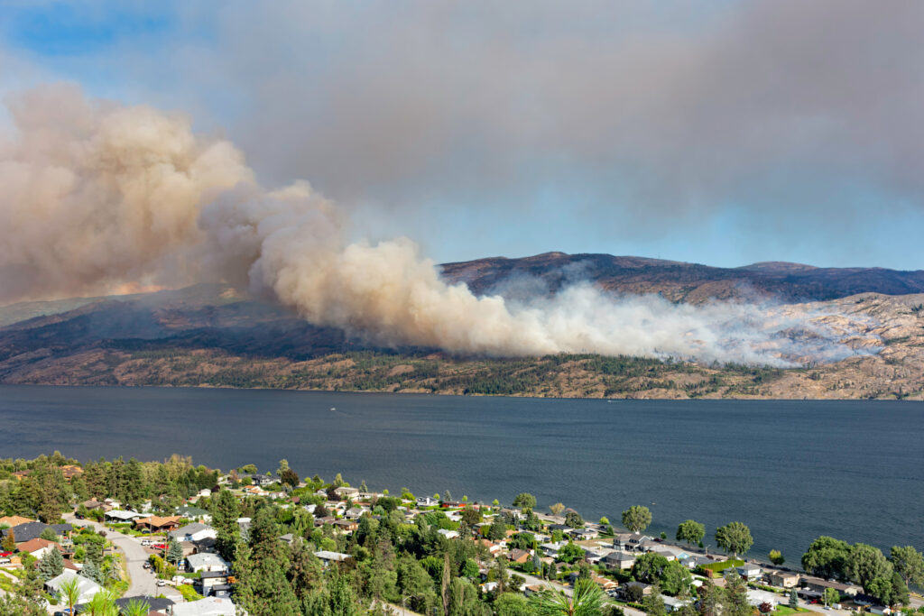
In BC, we are supporting the City of Kelowna with developing a climate action plan to reduce greenhouse gas emissions while reducing climate risks. Kelowna is aiming to reduce greenhouse gas emissions by 50% by 2030, relative to 2007 levels, while minimizing climate risks. Floods, wildfires, and heat waves are key hazards affecting the region. As in Whitby, shifting development plans away from flood plains and areas at high-risk of being affected by wildfire can minimize this risk. Currently, many new homes and buildings are slated to be built in high-risk areas as the city grows.
Planting trees is another key recommendation in the draft plan. Trees and vegetation help cool neighbourhoods during heat waves and, as Kelowna grows and becomes more densely populated, the cooling benefits of trees, parks, and greenspaces will amplify. Our analysis showed that over 14,000 residents will be protected from heat waves by 2040 by increasing tree canopy coverage by 5% across urban and core areas. With this information in hand, the City of Kelowna can prioritize investments in its tree canopy, knowing that it will reduce carbon dioxide pollution and protect its residents from intense heat while making the city greener.
50%
Kelowna’s greenhouse gas emissions reduction goal for 2030
14k
residents protected from heat waves by 2040

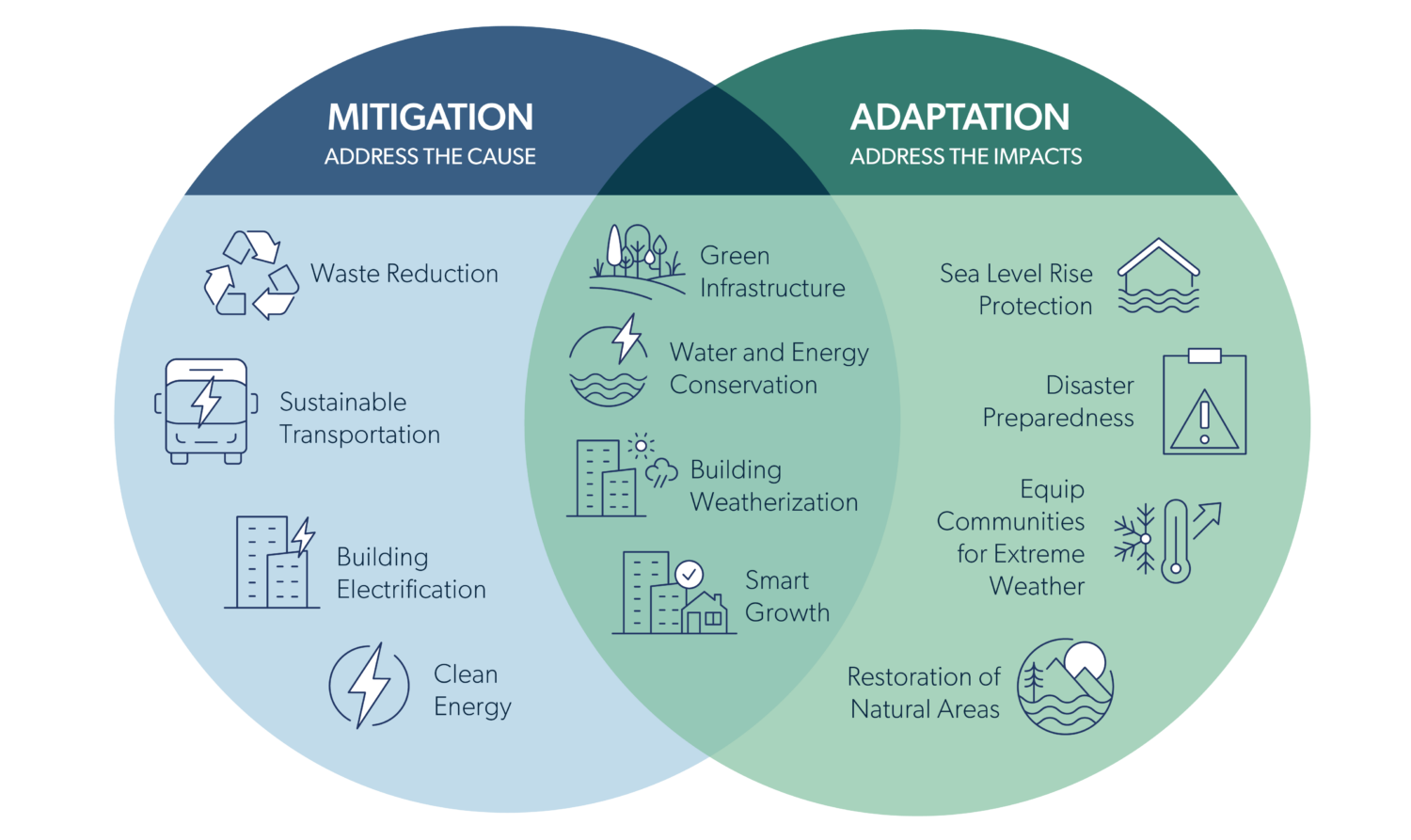
As in Kelowna, some of the most powerful climate adaptation actions overlap with measures that reduce greenhouse gas pollution. From planning when and how to develop new homes to installing renewable energy systems that are resilient to extreme weather, climate action plans can strengthen their impact by considering climate adaptation alongside greenhouse gas mitigation. We’re excited about how ScenaAdaptation can help to illuminate these synergies and other key insights to build safer and healthier communities.

Photo: Stan Jones/stock.adobe.com
Contact Us
Want to learn more about our climate adaptation services?


